
Other
VanDenBurg and Janecke, 1997, Geologic map of Everson Creek Quadrangle SW Montana from Cenozoic Tectonic and Paleogeographic Evolution of the Horse Prai.pdf
(1997)
Abstract
ABSTRACT
Cenozoic Tectonic and Paleogeographic Evolution of the Horse Prairie
Half-Graben, Southwest Montana
by
Colby J. VanDenburg, Master of Science
Utah State University, 1997
Major Professor: Dr. Susanne U. Janecke
Department: Geology
The Horse Prairie basin (HPB) of southwestern Montana is a complex, eastdipping
half-graben that contains three angular unconformity-bounded sequences of
Tertiary lacustrine, paludal, and fluvial sediments overlying middle Eocene volcanic rocks.
The basin is near the eastern edge of the Cordilleran thrust belt, and represents the western
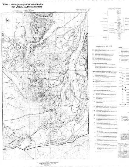
half of a larger Paleogene rift basin. Geologic mapping within the Everson Creek and
Bannock Pass 7.5 minute quadrangles indicates that five temporally and geometrically
distinct episodes of extension characterize the late Mesozoic (?) to Cenozoic tectonic
evolution of the upper HPB.
The first episode of extension occurred prior to emplacement of middle Eocene
volcanic rocks on an enigmatic, low-angle, southeast-dipping fault. Pre-volcanic extension
(?) may reflect gravitational collapse of the Sevier thrust belt beginning in the late
Mesozoic. The second episode of extension occurred in middle Eocene time on northwestdipping
syn-volcanic normal faults. Syn-volcanic faults can be attributed to extension of
the Challis volcanic arc, and typically accommodate less than I km of dip-slip separation.
The third generation of normal faulting occurred on the low-angle, south-southwest- and
west-dipping Lemhi Pass and Maiden Peak fault systems, respectively. Slip may have
iii
initiated during the waning phases of Challis volcanism, but these late to post-volcanic
normal faults probably reflect continued gravitational collapse of the Sevier thrust belt,
because they generally parallel contractional structures in the region. Late to post-volcanic
normal faults accommodate the bulk of extensional strain in the study area, and are
responsible for the deposition and preservation of the majority of basin-fill deposits in the
HPB. Two episodes of middle Miocene and younger extension also occur within the study
area; however, structural and basin analysis indicates the HPB experienced only minor
extension in the last 17 m.y.
Spatial and temporal relationships between magmatism and extension suggest that
large magnitude extension in the HPB (episodes I and 3) was not associated with
magmatism, and that extension in this portion of the Basin and Range province initiated due
to gravitational instabilities imparted on the crust during the Sevier orogeny.
(152 pages)
Keywords
- Extensional basin,
- break up,
- Challis volcanic rocks,
- Everson Creek quadranlge geologic map
Disciplines
Publication Date
1997
Comments
MS thesis, and particularly the geologic map contains coauthored materials of VanDenburg and Janecke. Some are in other publications, and some are only in the thesis.
Citation Information
Recommended Citation for the MS thesis that contains this coauthored geologic map at USU is:
VanDenburg, Colby J., "Cenozoic Tectonic and Paleogeographic Evolution of the Horse Prairie Half-graben, Southwest Montana"
(1997). All Graduate Theses and Dissertations. Paper 4690.