
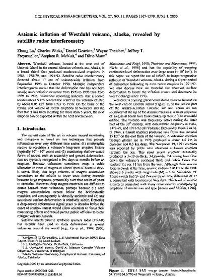
Westdahl volcano, located at the west end of Unimak Island in the central Aleutian volcanic arc, Alaska, is a broad shield that produced moderate-sized eruptions in 1964, 1978–79, and 1991–92. Satellite radar interferometry detected about 17 cm of volcano-wide inflation from September 1993 to October 1998. Multiple independent interferograms reveal that the deformation rate has not been steady; more inflation occurred from 1993 to 1995 than from 1995 to 1998. Numerical modeling indicates that a source located about 9 km beneath the center of the volcano inflated by about 0.05 km³ from 1993 to 1998. On the basis of the timing and volume of recent eruptions at Westdahl and the fact that it has been inflating for more than 5 years, the next eruption can be expected within the next several years.
Geophysical Research Letters, v. 27, issue 11, p. 1567-1570
Copyright 2000 by the American Geophysical Union.
Available at: http://works.bepress.com/stephen-mcnutt/2/