
Rebecca Seifried: https://orcid.org/0000-0002-4372-2164
Chelsea Gardner: https://orcid.org/0000-0003-0959-3845
- travel writing,
- least-cost analysis,
- geographic information systems,
- geospatial,
- landscape archaeology
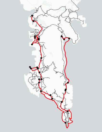
GIS data created by mapping Patrick (Paddy) and Joan Leigh Fermor's journey through the Mani peninsula in 1951. The zip file contains 6 layers (in GeoJSON format) that can be used to display least-cost models of portions of their route, the hikes we carried out to recreate them, and our final interpretation of their route from start to finish.
This research was made possible through the Anna C. and Oliver C. Colburn Fellowship, awarded by the American School of Classical Studies at Athens and the Archaeological Institute of America. Additional funding and support was provided by the Social Sciences and Humanities Research Council of Canada, the Killam Foundation, the Society for Women Geographers, the Crake Foundation, the Diros Project, the University of British Columbia, Mount Allison University, the University of Hawai’i, Acadia University, and the University of Massachusetts Amherst.
The README.txt can be found in the zipped data file.
Rebecca Seifried: https://orcid.org/0000-0002-4372-2164 Chelsea Gardner: https://orcid.org/0000-0003-0959-3845