
Article
Co-Located Contemporaneous Mapping of Morphological, Hydrological, Chemical, and Biological Conditions in a 5th-Order Mountain Stream Network, Oregon, USA
Earth System Science Data
(2019)
Abstract
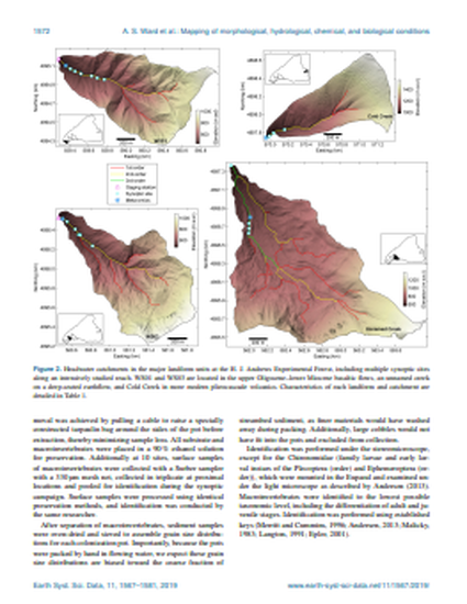
A comprehensive set of measurements and calculated metrics describing physical, chemical, and biological conditions in the river corridor is presented. These data were collected in a catchment-wide, synoptic campaign in the H. J. Andrews Experimental Forest (Cascade Mountains, Oregon, USA) in summer 2016 during low-discharge conditions. Extensive characterization of 62 sites including surface water, hyporheic water, and streambed sediment was conducted spanning 1st- through 5th-order reaches in the river network. The objective of the sample design and data acquisition was to generate a novel data set to support scaling of river corridor processes across varying flows and morphologic forms present in a river network. The data are available at https://doi.org/10.4211/hs.f4484e0703f743c696c2e1f209abb842 (Ward, 2019).
Disciplines
Publication Date
October 22, 2019
DOI
10.5194/essd-11-1567-2019
Publisher Statement
For a complete list of authors, please see article.
Citation Information
Adam S. Ward, Jay P. Zarnetske, Viktor Baranov, Phillip J. Blaen, Nicolai Brekenfeld, et al. "Co-Located Contemporaneous Mapping of Morphological, Hydrological, Chemical, and Biological Conditions in a 5th-Order Mountain Stream Network, Oregon, USA" Earth System Science Data Vol. 11 Iss. 4 (2019) p. 1567–1581. Available at https://works.bepress.com/kevin-roche/#/
Creative Commons license

This work is licensed under a Creative Commons CC_BY International License.