
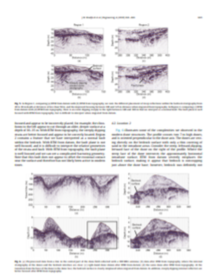
In ground-penetrating radar (GPR) imaging, it is common for the depth of investigation to be on the same order as the variability in surface topography. In such cases, migration fails when it is carried out from a datum after the application of elevation statics. We introduce a reverse-time migration (RTM) algorithm based on the second-order decoupled form of Maxwell’s equations, which requires computation of only the electric field. The wavefield extrapolation is computed directly from the acquisition surface without the need for datuming. In a synthetic case study, the algorithm significantly improves image accuracy over a processing sequence in which migration is performed after elevation statics. In addition, we acquired a field dataset at the Coral Pink Sand Dunes (CPSD) in Utah, USA. The data were acquired over rugged topography and have the complex internal stratigraphy of multiply eroded, modern, and ancient eolian deposits. The RTM algorithm significantly improves radar depth images in this challenging environment.
Available at: http://works.bepress.com/david_wilkins/17/