
Contribution to Book
Geologic Framework and Glaciation of the Central Area
Handbook of North American Indians
Document Type
Contribution to Books
Publication Date
1-1-2006
Disciplines
Abstract
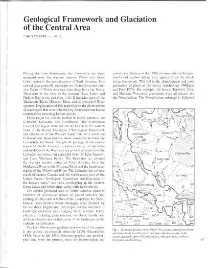
During the Late Pleistocene, the Laurentide ice sheet extended over the western interior Plains and Great Lakes region in the central of North America. This central area generally encompasses the northwestern interior Plains of North America, extending from the Rocky Mountains in the west to the western Great Lakes and Hudson Bay in the east (figs. 1-2). It includes parts of the Mackenzie River, Missouri River, and Mississippi River systems. Deglaciation of this region led to the development of landscape that were inhabited by Rancholabrean faunal communities including human groups.
Citation Information
Christopher L. Hill. "Geologic Framework and Glaciation of the Central Area" Handbook of North American Indians (2006) Available at: http://works.bepress.com/christopher_hill/57/
This document was originally published in Handbook of North American Indians.