
Image
Habitat for Humanity's Lower 9th Ward Development Initiative
(2016)
Description
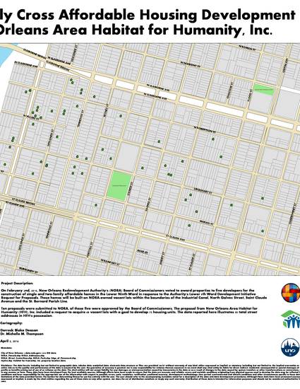
In response to the New Orleans Redevelopment Authority’s Lower 9th Ward Development Initiative Request for Proposals, Habitat for Humanity (HFH), Inc. was awarded 48 vacant lots to construct single and two-family homes in the Lower 9th Ward. I provided a scope of services for HFH which included: converting the property data provided by HFH into a GIS-ready format (cleaning of data), converting the data into vector features in GIS, and creating maps displaying reported vacant lots within the neighborhood boundaries. These maps continue to support the organization as they move forward with their community outreach endeavors.
Keywords
- Lower 9th Ward,
- New Orleans Redevelopment Authority,
- Habitat for Humanity,
- GIS,
- mapping,
- arcmap,
- arcgis
Disciplines
Publication Date
Spring May 11, 2016
Citation Information
Derreck Blake Deason and Michelle M. Thompson. "Habitat for Humanity's Lower 9th Ward Development Initiative" (2016) Available at: http://works.bepress.com/derreck_blake_deason/18/