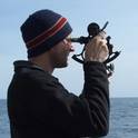
This paper presents results from recent work using structured light laser profile imaging to create high resolution bathymetric maps of underwater archaeological sites. Documenting the texture and structure of submerged sites is a difficult task and many applicable acoustic and photographic mapping techniques have recently emerged. This effort was completed to evaluate laser profile imaging in comparison to stereo imaging and high frequency multibeam mapping. A ROV mounted camera and inclined 532 nm sheet laser were used to create profiles of the bottom that were then merged into maps using platform navigation data. These initial results show very promising resolution in comparison to multibeam and stereo reconstructions, particularly in low contrast scenes. At the test sites shown here there were no significant complications related to scattering or attenuation of the laser sheet by the water. The resulting terrain was gridded at 0.25 cm and shows overall centimeter level definition. The largest source of error was related to the calibration of the laser and camera geometry. Results from three small areas show the highest resolution 3D models of a submerged archaeological site to date and demonstrate that laser imaging will be a viable method for accurate three dimensional site mapping and documentation.
Roman, C., Inglis, G., & Rutter, J. (2010). Application of structured light imaging for high resolution mapping of underwater archaeological sites. OCEANS 2010 IEEE - Sydney, pp.1-9, May 24-27.
Available at: http://dx.doi.org/10.1109/OCEANSSYD.2010.5603672
(c) 2010 IEEE. Personal use of this material is permitted. Permission from IEEE must be obtained for all other users, including reprinting/ republishing this material for advertising or promotional purposes, creating new collective works for resale or redistribution to servers or lists, or reuse of any copyrighted components of this work in other works.