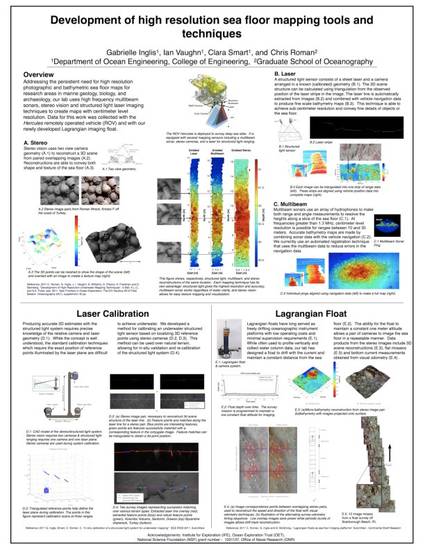
There is a persistent need for high resolution photographic and bathymetric maps of the sea floor for many research areas in marine geology, biology and archaeology. This poster will present recent work using high frequency multibeam sonars, stereo vision and structured light laser imaging techniques to create maps with centimeter resolution for these applications. This research involves the development of new image and sonar processing techniques that combat the typical difficulties of imperfect navigation information, limited sensor ranges and adverse environmental conditions associated with using marine robotic vehicles in the ocean. Data for this work has been collected with the Hercules remotely operated vehicle (ROV), which is part of the Nautilus ocean exploration program, and with our newly developed Lagrangian imaging float. The 2010 Nautilus expedition involved more than 80 technical and scientific collaborators from around the world working for four months at archaeogical and geological sites in the Aegean and Mediterranean Seas. Our new Lagrangian float is novel platform that provides high quality sea floor images with significantly less effort and cost than other current methods. The presented results will show direct comparisons between our visual and acoustic sensing modalities, an in-situ calibration procedure for structured light laser imaging, and the visual data products that can be produced by the Lagrangian float.